Industry of the Future
Ayana, an exploratory action to support the future of space exploration
Date:
Date:
Changed on 02/10/2024
The advent of the 'New Space' movement, which saw private companies enter a field that had previously been the preserve of governments, ushered in a new era for the aerospace industry. Since then, the sector has been booming, undergoing fascinating economic and technological changes. Sensors are evolving rapidly, offering new capabilities such as uncooled thermal infrared (TIR) and far ultraviolet imaging. With the advent of nanotechnologies and the new generation of Systems on Chips (SoCs), satellites are becoming more powerful than ever. Whether using high-resolution geostationary satellites, LEO-type low-earth orbit satellites, or industrial minisatellites and CubeSats in constellations, the possibilities are endless.
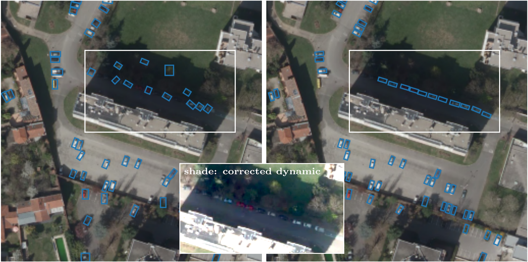
The AYANA exploratory project, led by Josiane Zerubia (Inria Côte d'Azur University Centre), is at the heart of this revolution. This interdisciplinary project, which draws on expertise in stochastic modelling, image processing, artificial intelligence, remote sensing and embedded electronics/computing, is designing computer programmes to automate the detection and tracking of objects of interest, by determining their dimensions and orientation, These are used in all areas of Earth observation, including urban planning, precision agriculture, natural disaster management, geological feature detection, geospatial mapping and information extraction for defence and security.
AYANA's work focuses on three main areas:
Funded by Bpifrance under the LiChIE contract, in close collaboration with Airbus Défence and Space in Toulouse, this research project began in 2020 and will run for five years. The aim is to improve the detection and tracking of objects using series of satellite images, making these techniques more effective and robust for a variety of applications.
To achieve this, AYANA draws on a wealth of data from very large images, with varying resolutions and spectral components. For example, Airbus D&S has provided the AYANA team with very high-resolution images and short video sequences taken by drones, as well as simulations of CO3D (COnstellation 3D), a new constellation of satellites scheduled to be put into orbit in 2025. At launch, this constellation will comprise four satellites equipped with advanced sensors, capable of capturing high-quality video with the aim of producing a 3D reconstruction of the Earth. The objects of interest have been detected and tracked using techniques combining artificial intelligence and stochastic modelling.
Decades of research into earthquakes have not yet made it possible to predict precisely when and where an earthquake will occur, or what its magnitude will be. This limits our ability to prevent these disasters effectively. Despite numerous research efforts, there are still major differences between the results of current models and the actual behaviour of earthquakes.
Part of AYANA's research work in collaboration with Géoazur at Sophia Antipolis is therefore devoted to the automatic detection of seismic faults, which is essential for modelling earthquakes in the future, using deep learning algorithms including generative models to improve our understanding of the risks associated with earthquakes.
AYANA's third area of research, in collaboration with the DITEN department at the University of Genoa, is aimed at developing new models combining probabilistic graphs and machine learning to better anticipate and respond to natural disasters such as earthquakes, floods and fires. These models, which use satellite images supplied by various European space agencies (CNES, ISA, ESA) as well as by Inrae, will be applied to concrete urban reconstruction and reforestation projects following natural disasters.